

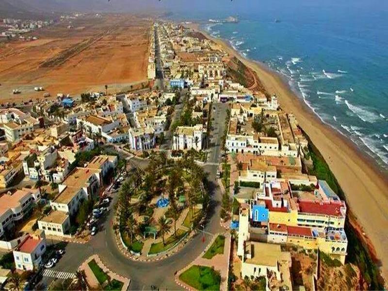
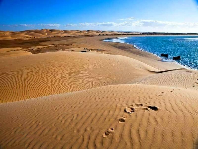
At 65 kms westward of Guelmim (28°52’12’’N 10°46’48’’W in 5 kilometres from Sidi Ifni, set to the left), the Plage Blanche is one of the most beautiful sites of the province which spreads over about 45 km. Lately it has been chosen among the main sites of the kingdom to accommodate the future sea resort from the Azur plan 2010 with 30 000 beds capacity
At 130 km, the Draâ wadi, track eastward of Guelmim (towards Tan-Tan (28°17’43’’N 11°31’49’’W) is the mouth of the wadi Drâa which is part of the most beautiful site of the Moroccan atlantic coast. A large valley ending by cliffs where the wadi flows intothin sanded beaches, into an imposing view. As for the mouth
of the wadi Chbika, not less than 72 birds species have been identified there.
Concerning the mammals, we find the hyena, the wild boar and the red fox. The presence of the cobra, snake being declining strongly in Morocco, is protected in this site
At 25 km northward of Tan-Tan towards Guelmim (28°34’00.87’’N 11°03’41.61’’W), the wadi Draâ, one of the most atlantic coast beautiful sites where you will discover not less than 72 birds species.
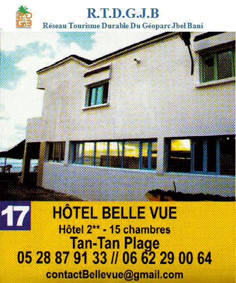
Hôtel BELLE VUE
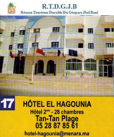
Hôtel EL HAGOUNIA
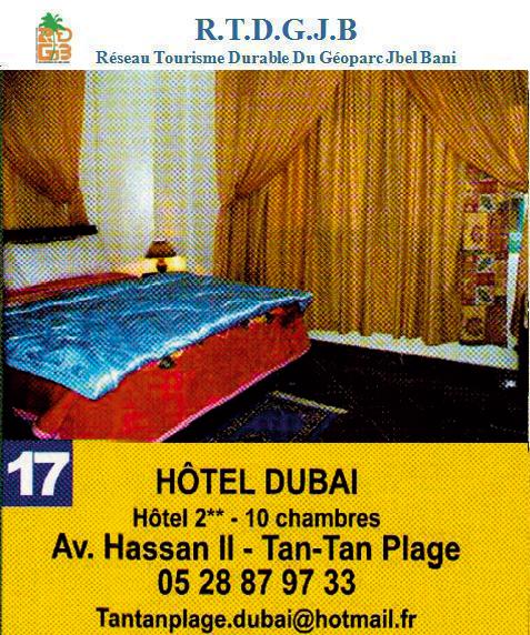
Hôtel DUBAI
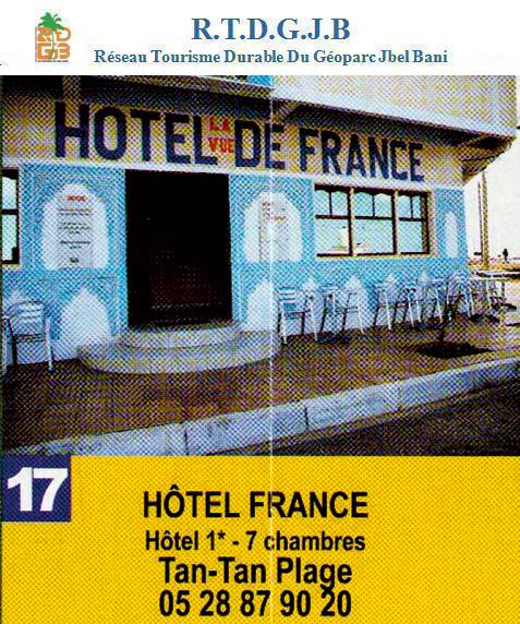
Hôtel France
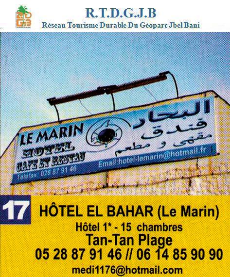
Hôtel EL BAHAR
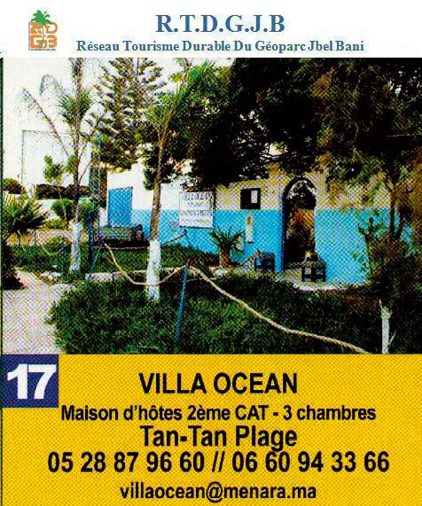
Maison d'Hôtes VILLE OCEAN
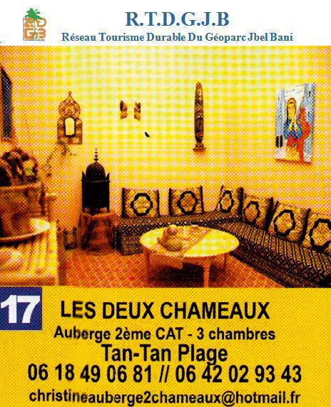
Auberge LES 2 CHAMEAUX
At 24 km westward of Tan-Tan towards Laâyoune (28°28’54.90’’N 11°20’55.60’’W), apart from the fishing port, EL OUATiA commune has got wide beaches. Fish restaurants, hotels and guests houses, offers you the possibility of having a nice stay, far enough from the port which constitutes the essential of the economic activity of the area.
At 50 km southward of town towards Laâyoune (28°17’27’’N 11°31’55’’W), the wadi mouth. The view is beautiful (magnificent beaches, cliffs, thin sand dune), wadi Chbika has the advantage of being on the side of the road and of having a migrating birds natural park such as pink flamingo, great cormoran, black scoter and the little pinguin. This will allows you to give yourself up to the joy of a photographic safari. To be mentioned also the presence of mammals such as the common hyena, wild cat and jackal.
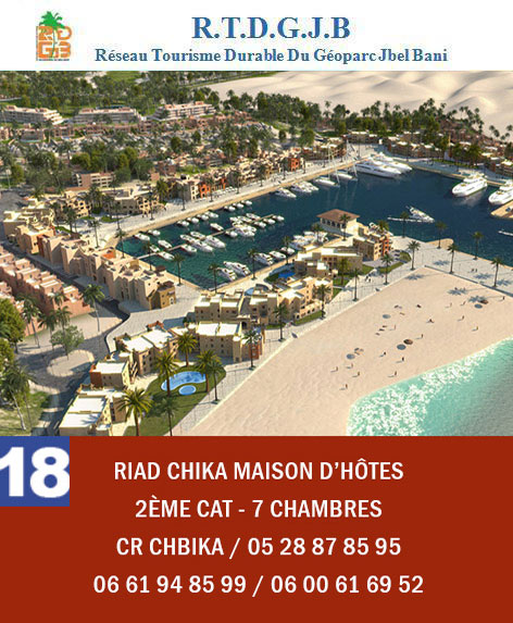
RIAD CHIKA Maison d’Hôtes
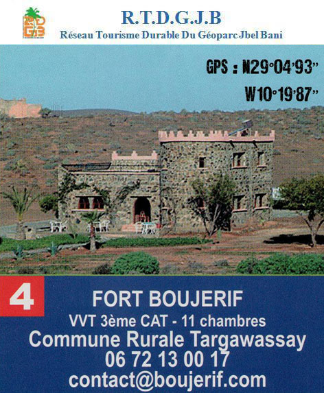
FORT BOUJRIF VVT
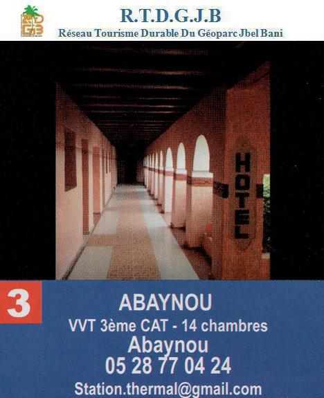
VVT ABAYNOU
At 15 km, the Abaynou hot springs 39° (towards Sidi ifni) and Lala Mellouka (towards Tata). Located respectively at the north of Guelmim at the level of the Abaynou rural commune ant at 113 kms from the country tpwn of the area at the level of the Aday rural commune. The water of these springs offers cutative properties, notably in dermic and rheumatic illunesses.
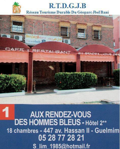
Au rendez-vous des Hommes Bleus
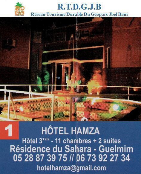
Hôtel Hamza
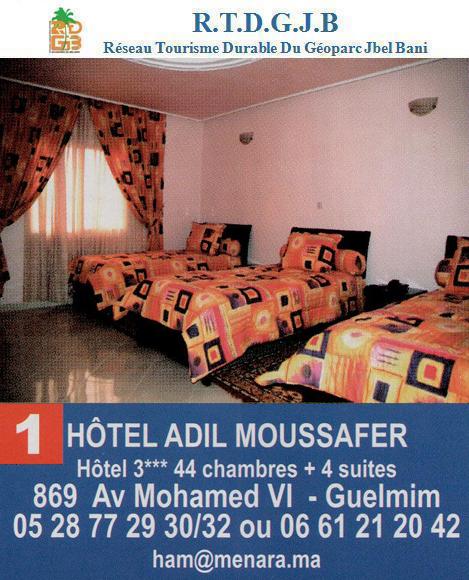
Hôtel ADIL Moussafer
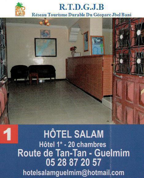
Hôtel Salam
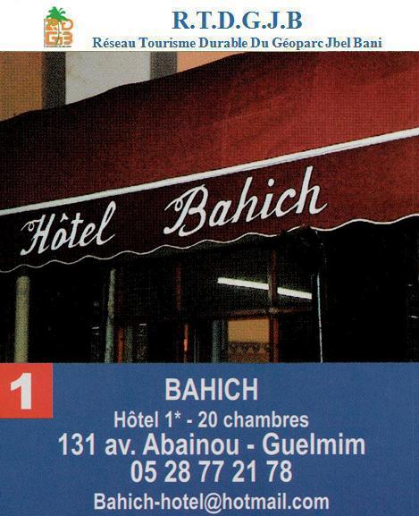
Hôtel Bahich
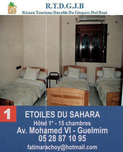
Hôtel ETOILES Du Sahara
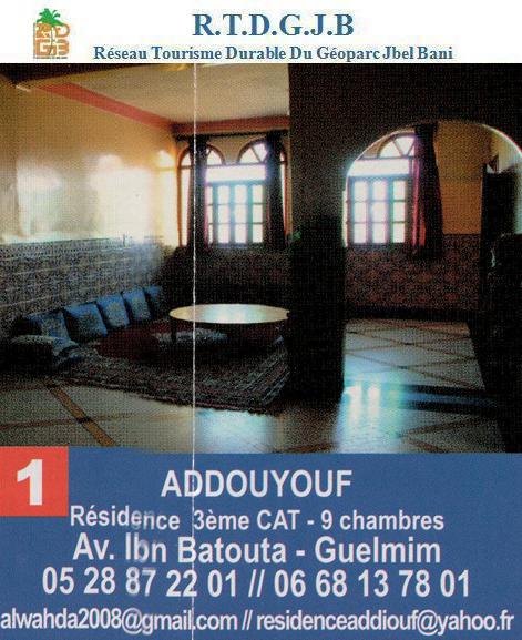
Hôtel Addoyouf
The site of Asrir towards Assa is located into a little dune shape valley at 10 km south of Guelmim (28°55'33 N 9°59'52W). As per the first archeological deductions from the Morocco-Spanish mission, it is probably the place of the caravaner city of Noul Lamta. The searchers investifations confirmed, actually, the middle-aged character of the site.
As per these researches, the site dating goes back to the Middle ages, knowing that Noul Lamta existed already before Okba Ibnu Nafi'a consquest. The set of problems delivered by the discovery of the location of this lost city is enormous. First of all, we have to confirm the pre-islamic character of the site and the stories about cimmercial relatiobs undertaken by the Phoenicians and the Carhaginians. We have alse to find evidence of the famous Noul Lamta money shop whose coins ara shown in the Moroccan and foreign museul.
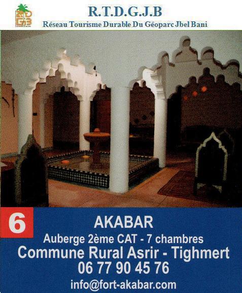
Auberge AKABAR
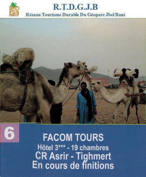
Hôtel FACOM TOURS
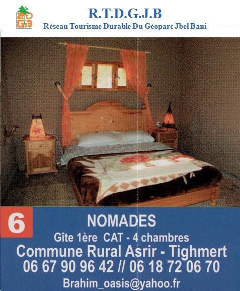
Gite NOMADES
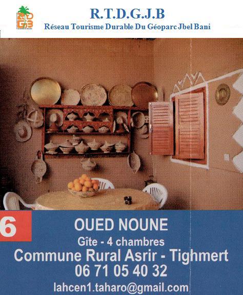
Gite OUED NOUN
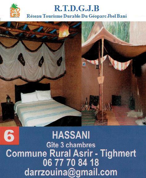
Gite HASSANI
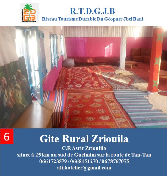
Gite Rural Zriouila
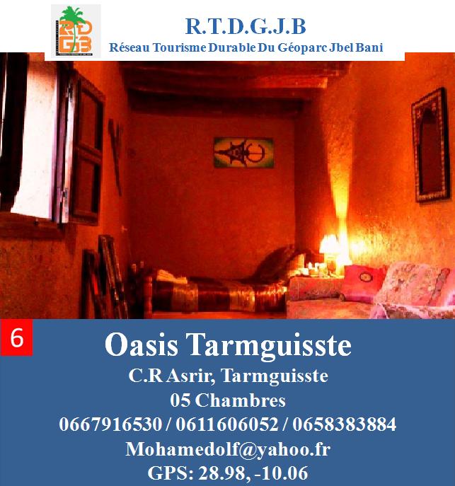
Oasis Tarmguisse
Oasis Ait Bakou Tighmert is eastward of Guelmim (Assa road). You will be able to discover a new tourist experience of oasis(in the inhabitant house) POS program(South oasis project) visit of an eno-museum.
At 25 km eastern of Assa (towards Tata) Boutssarfine track very well known by geologist; geologic site with a palm grove and running water all year long.
At 29 km to the North-East (including 7 km by track) Ouin Medkour oasis is located in a col sheltering the nomads cemetery. The site has got two Zaouïas allowing to the saint visitors to stay there. An hundred meters further away the “giant tomb” rises.
History or legend : the inhabitants of the area tells, in any case, that durign the 12th century an impressive size men tribes, who could reach 2,50m high would have lived in this very place.
Msied, reachable by a 39 km tarred road after Tilemzoune village, county town of the rural commune located at 29 km south-eastward of Tan-Tan is a commune where nomads and cattle farmers make up almost the whole population.
The area abunds in fields of mine. At 4 km from Msied, we discover a palm grove next to a mountain called by the name of Sidi Brahim El Atabi, marabout name buried at its crest
At 80 km from Aouinat Lahna, AOUiNAT AiT OUSSA (Aayoun Ighamane), the track is impressive by its wide landscape and the rocky mountains surrounding it.
Going through Tiglit, you will find Berber fig, summer fruit. Through Laaouina Ait Oussa, you can take the road towards Tan-Tan or the track towards Esmara and towards the borders Mauritania
50 kms west of Assa AOUINET TORKOZ ( Aouinat Lahna),An old track of the Paris-Dakar Rally currently tarred. One can discover a very impressive presaharian research station founded by jean-Bertrand Panouse.
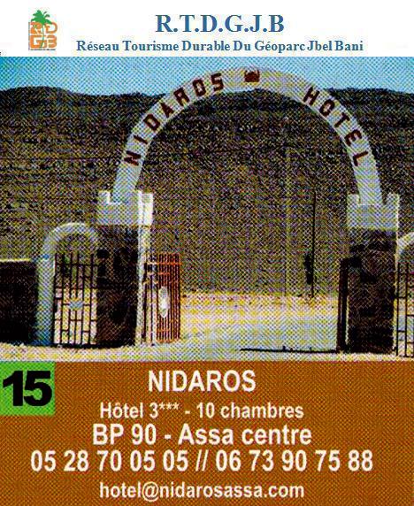
Hôtel NIDAROS
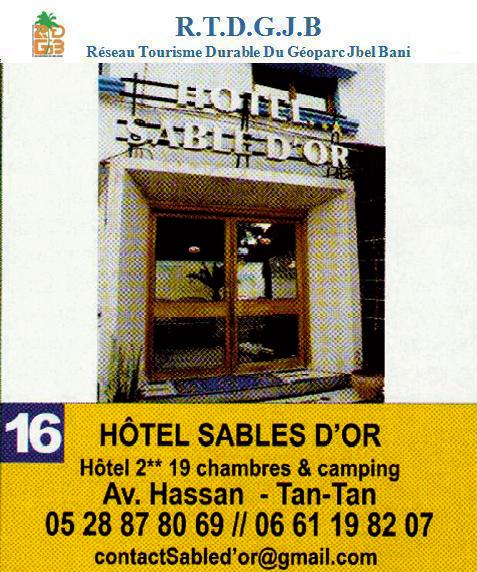
Hôtel SABLES D'OR
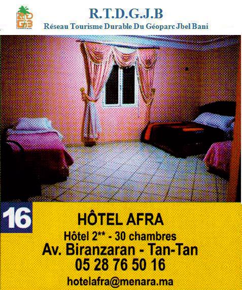
Hôtel AFRA
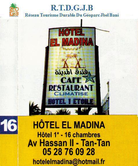
Hôtel El MADINA
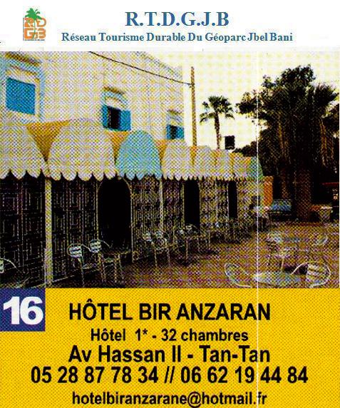
Hôtel BIR ANZARAN
Résidence DERAA

At 30 km westward of Aouinat Torkoz (track), OUM LAAOUiGAT,there, we can learn very quickly the life of the nomads, their way of life and discover their every day life.
Acacia forest and biodiversity very varied. There, you can go on
dromedary’s back with the help of friendly people. Welcome and reception under the tents.
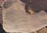
From the town center the "oasis" direction sign, pass the Assa wadi and you will discover the old ksar of Assa on the rocky crest (28°36,42'N 09°25,86 W), fool walks in the ksar (rehabilitation in progress as per the APDS) where you can engravings worth to look at.
At 8 km from Assa towards Tata, (28°37’26.52’’N 9°23’59.22’’W) eastward of the town, Odette de Puigaudeau and Marion Senonès, explored in 1951, at the locality of Ikhf Ighir, 2 sites of cave engravings. They already have been indicated by the Rabbi Mardochée ben Serour
At 40 km south-eastern of Assa (towards Zag) TOUiZGUi, nomads,rocky mountains, cols and Drâa valley, cave engravings and palmgrove place.
At 29 km northward of Msied, lengthened wadi Jrifia, where numerous trees called “Talh” grow inside. They give to this landscape some savana-like looking. This site numbers also numerous moving thin sand dunes having the characteristic of healing rheumatism, thanks, mainly to its cleanliness and to the dry climes which reigns here. This area, populated by various animal species such as the gazelle and the jackal is called to be a park in the next future.
At 78 km (including 4 by track) southward of Tan-Tan, we find Elkhloua grottos. it is a prayer place digged and made-up in therock
At 50 km southward of Msied (towards Es-Smara), at Azguerre, there is cave engravings of a great and exceptional prehistoric and protohistoric richness. There is anthropomorth cave paintings discovered in 2001.
These discoveries are not yet exploited and can play an important part in the cultural tourism development of the province
At 80 km eastward of Assa, ZAG, urban city which reckons most of basic infrastructure, cave engravings and the palm grove
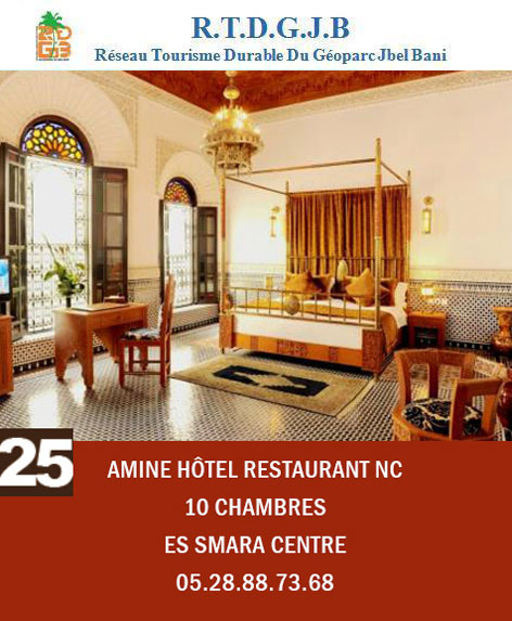
AMINE Hôtel Restaurant NC
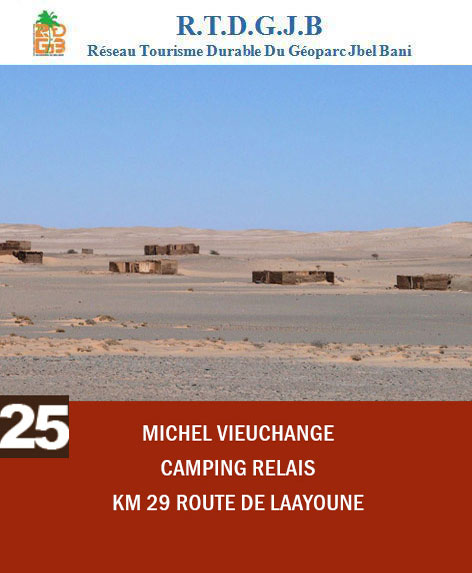
Michel VIEUCHANGE
At 20 km, southward of Es-Smara, (26°34’58.68’’N 11°42’46.08’’W),cave engravings site, you will follow a track along the wadi Selouan
At 23 km, cave engravings of the wadi Selouan. (26°33’04.68’’N 11°42’28.20’’W)
At 30 km, cave engravings of the wadi El Aasli Boukerch,(26°31’20.16’’N - 45°01.26’’W) at the edge of the wadi, drive till the rocky crest where you will find plentyful of engravings.
At 135 km, cave engravings of the wadi Tazouwa, (26°35’36.00’’N 11°32’55.80’’W) due North, 2 magnificent pre-islamic Tombs and cave engravings
At 145 km, cave engravings of the wadi Mirane (26°40’13.80’’N 11°29’36.60’’W) exceptional pre-islamic tombs and uncommonly rich cave engravings on several thousands of meters.
At 80 km, cave engravings of Amgala, (26°35’36.00’’N 11°32’55.80’’W) head for due South, pre-islamic Tombs, rendezvous for various and numerous graffiti
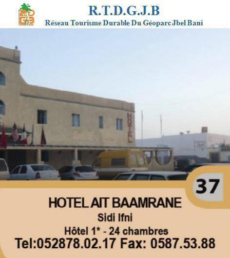
Hotel Ait Baamrane
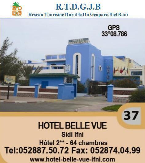
Hotel Belle vue
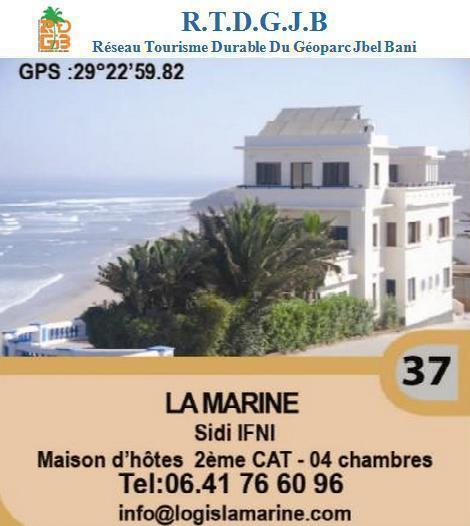
La Marine
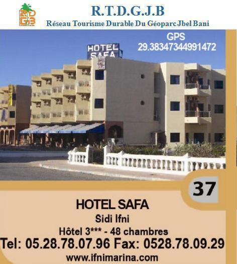
Hotel safa
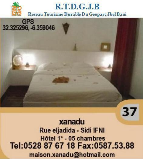
Xanadu
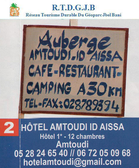
Hôtel AMTOUDI ID AISSA
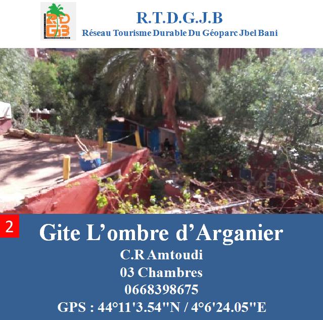
Gite L'ombre d'arganier
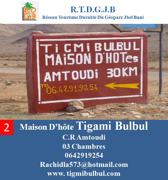
Maison d'hôte Tigami Bulbul
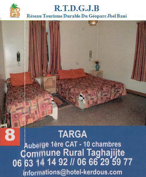
Auberge TARGA
Camping Tinoubga

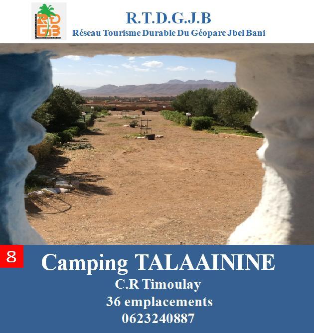
Camping Talaainine
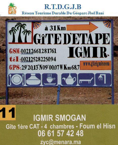
Gite IGMIR Smogan
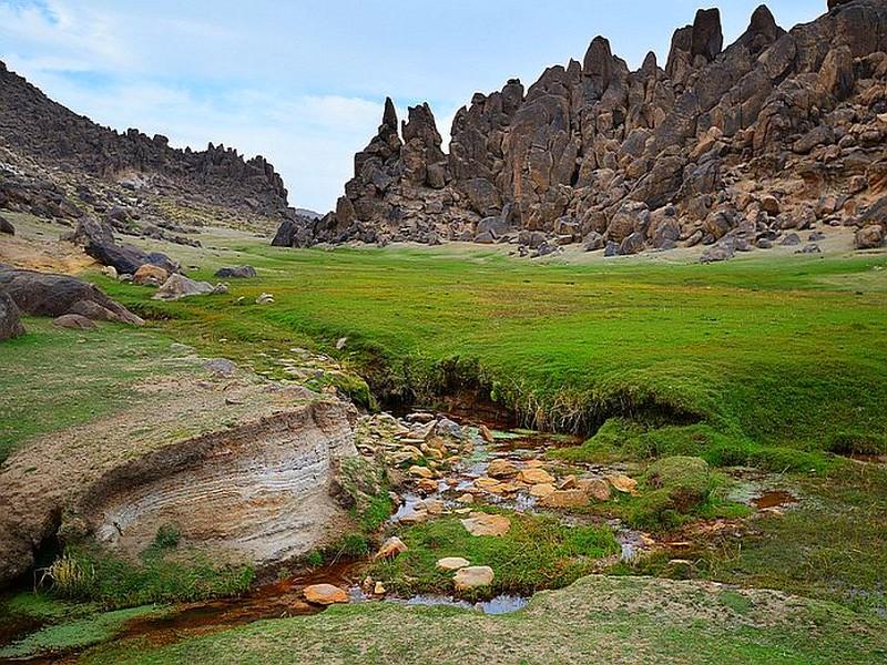
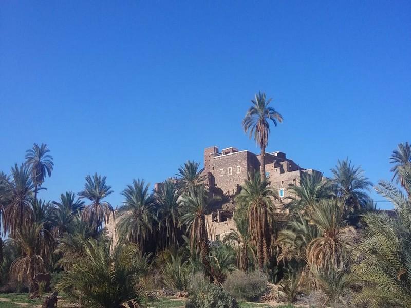
At 120 km eastward of Guelmim (towards Tata), the Amtoudi valley with its kasbah and this Agadirs is an international reknown site.The research deal over about 150 kms from the wadi noun basin, which allowed the discovery of more than 270 archeological and ethnographic sites , including notably “Asrir”, “Tigami Ougallid” (the sultan house), an Almohad Kasbah opened to the aghjirjt and “Adrar Zerzem” oasis which includes more than 265 stone engravings.
A wadi runs among the argan trees, the palm trees, the fig trees and the almond trees, in the middle of the valley which, in places, narrows to go between two high and impressive 200 meters high walls : walks on mules back or on four-wheel drivesis recommended.
We know today that most of the civilization trends which have been detected in Sahara reached its north border and even then the mountains of the Moroccan South.
The first occupants were blacks which presence has been certified by the engravings of Tassili (5th century BC).
Various white populations make up the Berber (called Lybico-Berber) Mediterranean who lived in Spain, Morocco, Moroccan Sahara and Canaries.
Palestinian charmite came by sea and land.
Semite arrived by emigration waves (10th century BC) searching for gold, silver or copper mines, either by sea or through desert.
Thus, Berber seams to have received from Mediterranean and Egypt their eldest element of civilization.
In 622, comes the islamic era. From 670, Oqba Ibn Nafi, at the head of the first arabic conquerors army, arrives in The Maghreb and founds Kairouan. In 681, he will mount a raid as far as Draâ and Souss. In 710, Moussa Ibn Noussair receives submission of the whole of The Maghreb in care of the caliph Omeyyade from Damas.In 786, Idriss the 1st, descendent from Ali, prophet’s son-in-law runs away from Arabia and finds a place of refuge in Morocco; as from 788, he has been recognized iman by Berber from Morocco.
Almoravide Dynasty 1055-1144 : The nomadic Berber almoravide warriors progress to the North, found Marrakesh in 1070 which becomes the capital of the kingdom, to who it gave its name : Morocco.
Amohade Dynasty 1130-1269 : The capture of Marrakesh in 1147 makes an end to the conquest of Morocco by the Almohades (the Unitarians). Abd el-Moumen manages to unify North Africa.
Merinide Dynasty 1269-1471 : the Beni Merin from Zenetes, coming from the Moulouya basin seizes Fes, Rabat, Sale and Abdou. Youssef Yacoub takes over Marrakesh in 1269.
 The Cherifan movements : Since 1508, the Portuguese compete with the transaharan trade. Coming from the Beni Saad arabic tribes, Mahomet descendants, originating from the Drâa Valley, the Saadian cherif el-Kaim resists to the Portuguese as from 1509. The Cherifan power is officialized when Marrakesh got seized in 1525.
In 1578, the Saadan secures the gold road control by seizing Timbuktu and the Niger loop.
The Alaouite Dynasty : Birth of the Cherifan empire. Native from the Chorfa from Tafilalet, Ali descendant, the dynasty imposes its authority as from 1666. Moulay Ali Cherif, its founder, and its successors reunify Morocco and founds the Cherifan empire which spreads its authority as far as Senegal. To strengthen its external relations, he treats Louis the 15th and Jack the 2nd from England as equals.
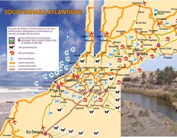
Guelmin- Es Smara area : Spreads over a surface of 142 380 km², that is to say almost 20% the kingdom area. Strengthen by its priviledged geostrategic position, the variety of its natural sites, the area gathers all the ingredients of a center of tourist developments on a large scale.It is more than 170 kms of Atlantic coast (Guelmin and Tan-Tan districts), from where la plage Blanche spreads over 40 kms, Oued Chbika, also its hot springs. The area has actually at its disposal important potentials, its various natural scenery and the richness of its cultural heritage thanks to the mixing of Hassani and Berber cultures and traditions.
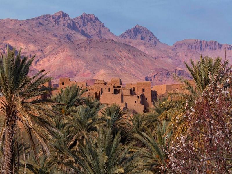
The oasis from the communes of Taghijt, Asrir, Tighmert, Ifrane of the Anti-Atlas and Timoulay include several tourist appeals : the Ksours and Kasbahs, the historical sites along the wadi Noun and at Kahf Lahmam (pigeons grotto) in the commune of Ait Bouflen, the Igoudas or collective shops (Amtoudi) and the cave engravings.
 The palm groves from the district of Tata (Akka, Tata, Foum Zguid) and from the district of Assa-Zag (Assa) count among the most important ones in the south of Morocco (more than a million palm trees that is to say 20% of date palm national heritage).
The hot springs, notably the ones of Abaynou and Aïn Lalla Mellouka the water is renown for the treatment of dermic and rheumatic illnesses, which have therefore curative effects.
Foum Assaka, tourist interest site attracts already the tourist professionals. This coast of great views and ecological richness is the subject of tourist vocation.
Foum Draâ, isolated site and difficult to accede by track from the national road RN1. It sets out a remarkable views quality with varied fauna. The site has been the subject of a detailed analysis of a future tourist development as part of a study on a tourist area schedule and development which will number 8 000 beds.
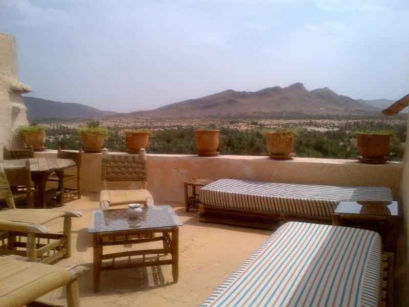
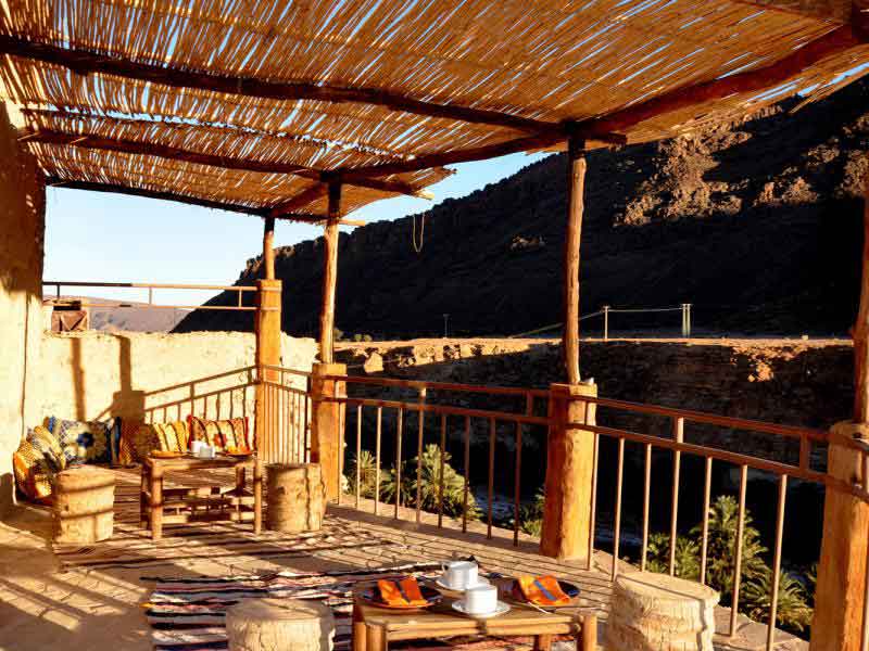
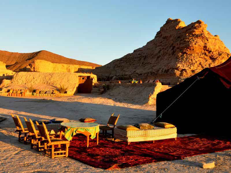
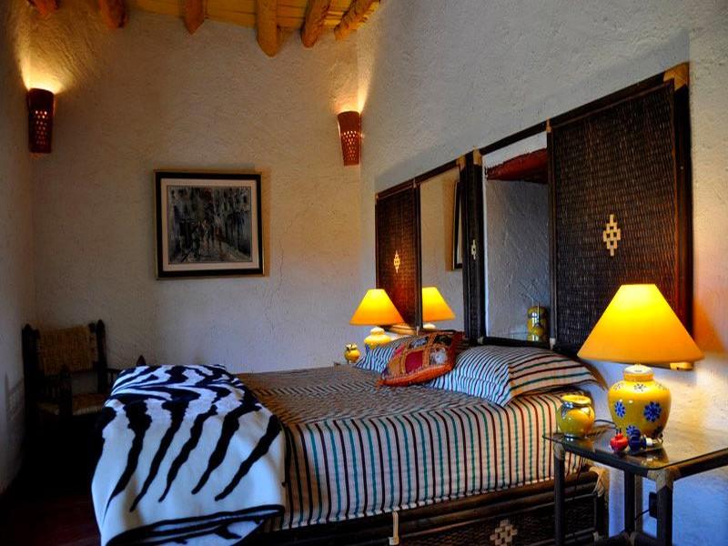
In addition of the mouths, the wadi surroundings towards the inside offer a tourist attraction potential a not inconsiderable one which arouses the investors interest from the tourist sector. It is the case, notably, of a french property developer who has built a hotel unity at Fort Boujrif (rural commune of Targawassay- commune of Guelmim) who knows an important success by attractring more than 400 tourists from different nationalities by month. Same thing for the Ksar of Tafnidilt located along the Draâ wadi and which knows the same success, the station Abaynou, eco Musée of Tighmerte. 2 other implementations Dar Infiane at Tata and the Akka Nait Sidi VIP bivouac (rural commune of Tissint) are to be mentioned for the same original concept and for its success.
Plage Blanche, this unity would be developed at 50 kms from the south of Ifni and at 60 kms from the south-east of Guelmim. Its particularity will be of being the first eco tourist seaside resort with 30 000 beds capacity.
 Hotel units ( 5* and 4* hotels and villages for tourist holidays) for about 5 300 beds capacity. An 18 holes golf, an commercial and craft center, a SPA and leisure implementations.
Residential unities for a total 10 500 beds capacity, about 2 200 flats and villas. The Fades group estimated that the works would last 8 years, the first hotel is planned to open its doors on 2012.
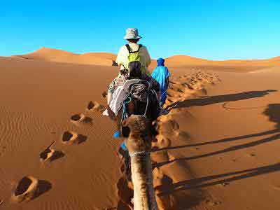
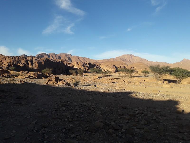
The National Park “Bas Draâ” is one of the most important national park, with a desert landscape and low human density. It constitutes an ideal biotope for a diversified and rich fauna nearly dying out (gazelles, dorcas, cuffed wild sheeps, carnivores including the striped hyena, jackal, red fox, fennec, porcupine, as well as birds as bustard, lancer falcon, the royal eagle, adding on reptiles). It is a biodiversity of high interest potential.
Chbika wadi, Foum Chbika site, at about 30 kms from the south of El Ouatia The convention on the installation of the tourist station «oued chbika «in tan tan,entrusted to the Egyptian group»orascom»has required an amount of 6 billions dirhams.the project which will contribute to the creation of 2.500 jobs,consists of the realization of hoteliary units with a capacity of 5.000beds,of residences(1.851units),ludic and sporting infrastructures(centre of congress,museum,and a sport center).
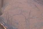
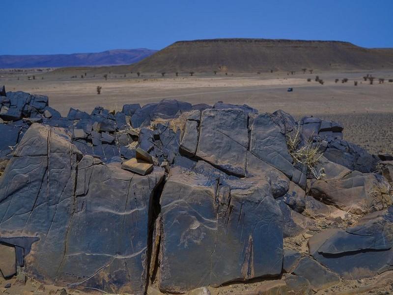
The cave engravings from the Tata district to the Es-Smara district, the first discoveries of cave art date back the 19th century.
At present, we number more than 300 sites spread over the whole territory.
 This sites, in which prehistoric men used to engrave, are often on the open-air and in general, located on the wadis side.
As per its geographical location, they can be classified into three concentrations :
 the Haut-Atlas plateau, along the Draâ valley and next to the dried-up wadis of the saharan districts. The cultural heritage of Morocco is represented through all of these periods from prehistory (from ancient Palaeolithic to Neolithic) to history, going by protohistory.
Some sites are the subject of active archeological researches. It allows us to distinguish the different stages of Morocco history over about one million years period. Cave art is one of the component of Moroccan historic heritage. During almost 8 000 years, men used to engrave magnificent “paintings” onto sandstones to illustrate the activities of day-to day life and its beliefs
 The pigeons grotto, (going to Agadir), some researchers discovered perforated sea molluscs Nassirius type, in the pigeons grotto at Tafoghalt, an area known for its magnificent grottos, human heritage treasures lying hidden.
Dated from 82 000 years, these are pieces numbered among the eldest, representing ornaments in the world and putting Morocco as a country where civilization aroused long ago before other parts of the world.
They indicate very clearly, as per great specialists who have received this discovery, that humans have used symbols in Africa, 40 000 years before Europe.
As per one of the scientifics : “such a discovery allows to close the meeting on the african origines about the items of ornaments and put North Africa, and notably Morocco, as one of the eldest centers of distribution of ornaments items in the world”.
The pigeons grotto ornament is elder than what has been discovered before in Algeria, in South Africa and in Palestine.
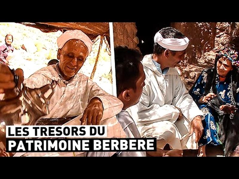
The savoir-vivre begins by different ways to welcome vistors with what is immediately available and presentable :
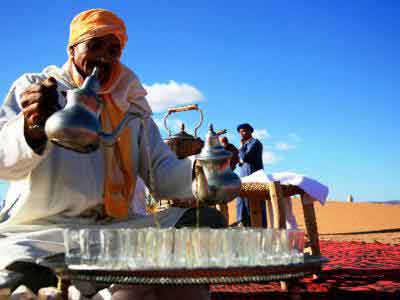
Milk, symbol of the purity of the intentions, peace desire; refreshing drink, tasty and nutritive. The most important is goat, camel or cow milk
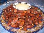 Dates (local palm grove products) go usually with the milk. Sweet, they equilibrate the blandness of the milk, scrape out the dust of the road which lay in the throat, perfumes nicely the breath and prepare to word exchanges. Tea, usually made with mint, national drink, is the first constant in welcoming tradition, from the most humble to the richest.
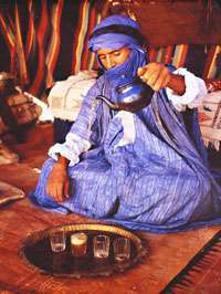 There is no home where a visitor won’t be served one, indeed several, glass of tea. It’s a meeting factor, a catalyst, communing symbol, rarely offered on
its own: it is served with batbout (small bread slightly risen), msemen (pancake with fat and baked in a terracotta dish).It can also go with
different types of cakes or biscuits, indeed, extreme pleasure, fresh bakedbarley or wheat bead. Lamriss, very well known drink in the sahara area, is a mix between cooked
floor and water adding a bit of sugar; very refreshing drink, moreover in summer and when there is no milk.
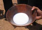 Zrig, very well known in the area. It is a mix of milk, water and a bit of sugar, with sometimes some yogurt.
How can we talk about welcoming and hospitality without making reference to its corollaries : savoir-vivre and art of cooking ?
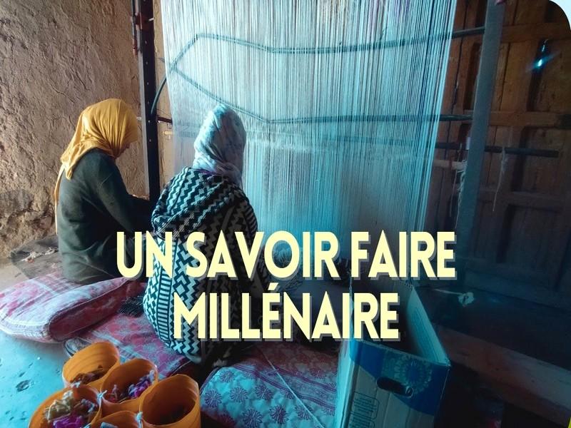
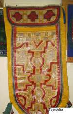 L’artisanat dans la région est le reflet d’un passé d’une civilisation spirituelle et matérielle.
Entre tradition et modernité, l’artisanat de la région s’ouvre sur les nouvelles technologies et prend la place qui est la sienne dans l’économie régionale en tant que facteur d’équilibre socio-économique.
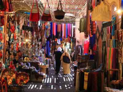
Domaine privilégié de la micro-entreprise, l’artisanat est un secteur d’activités important par le chiffre d’affaires qu’il génère et par la main d’oeuvre qu’il emploie (plus de 11000 artisans dans les différentes filières d’artisanat d’art et de service). Dans toutes les provinces, vous découvrirez : la bijouterie, la maroquinerie traditionnelle, le bois, la couture traditionnelle, le tissage de tapis, les pierres fossilisées, la vannerie (province d’Assa-Zag et de Tata), la poterie (province de Tata).
 The cooperative is composed of twelve (12) members seven (7 women and five (5) men) ...
 7 women compose it, it is presided by Mrs. Mariam Ait Said ...
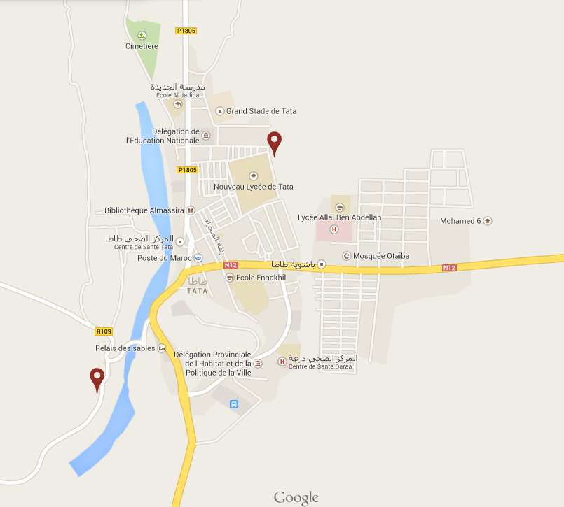
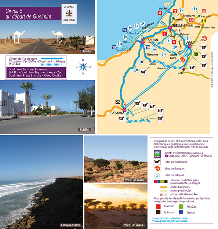
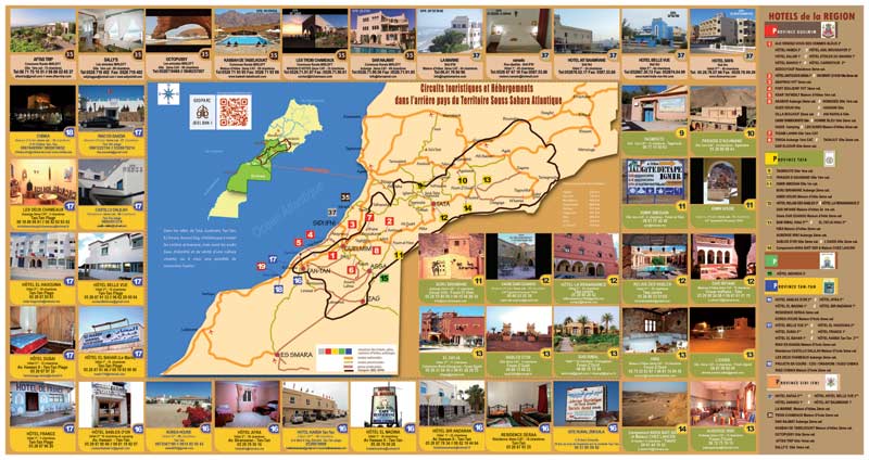
NB : Click on the icons in the map to view information for each item.
We know today that most of the civilization trends which have been detected in Sahara reached its north border and even then the mountains of the Moroccan South...
Read more...The oasis from the communes of Taghijt, Asrir, Tighmert, Ifrane of the Anti-Atlas and Timoulay include several tourist appeals...
Read more...Foum Assaka, tourist interest site attracts already the tourist professionals. This coast of great views and ecological richness is the subject of tourist vocation...
Read more...The savoir-vivre begins by different ways to welcome vistors with what is immediately available and presentable...
Read more...Craft in the area is the reflect of a spiritual and material civilization past. Between tradition and modernity...
Read more...
La maison d’hôte Dar Infiane vous accueille au Maroc du Sud, dans un auberge de plus de 500 années niché
Les chambres d’hôtes Chez Lahcen sont gérées en partenariat familial par le français Patrick Simo
Akka N'ait Sidi est un lieu qui vous offre une expérience insolite pour camper au Maroc en pleine desert
Les vidéos de la province de tata au sud du Maroc: Tata est une terre d'accueil, paysages époustoufla
Après un Master d'histoire à la Sorbonne et un an d'enseignement dans un lycée au Liban je réalise un vieux rêve en marchant sur les pas de Charles de Foucauld au Maroc. Ce jeune officier français était parti à 24 ans en 1883 pour renseigner la Société de Géographie sur ce pays alors très mal connu...
Tout savoir sur L'investissement touristique au Sud Maroc, les opportunités les a
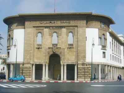
Tout savoir sur les établissements bancaires et financieres Sud Marocaine
Differents textes touristiques relatifs au Sud Maroc, et particulierement le territoire Souss Sah

Tout savoir sur les nouveaux classements touristiques au Sud du Maroc

Découvrir les promotion touristiques et bons plans a Souss Sahara Atlantique
Tourisme et dérivés a Souss Sahara Atlantique, et Grand Sud Atlantique
Actualités et articles sur tourisme dans la région Guélmim Oued Noun.
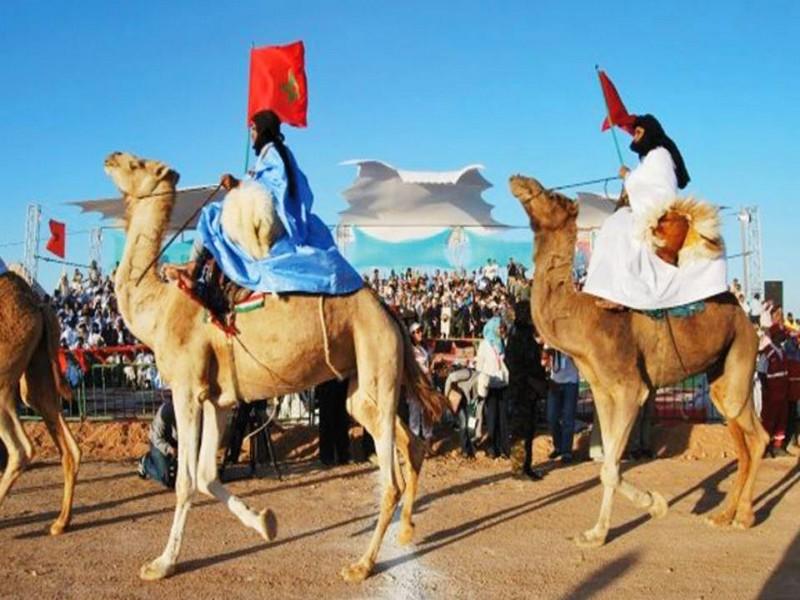
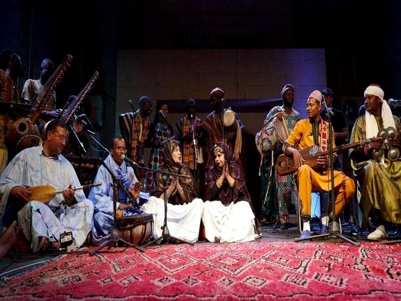
Découvrir les Moussem et Festivals de la région Guelmim Oued Nous
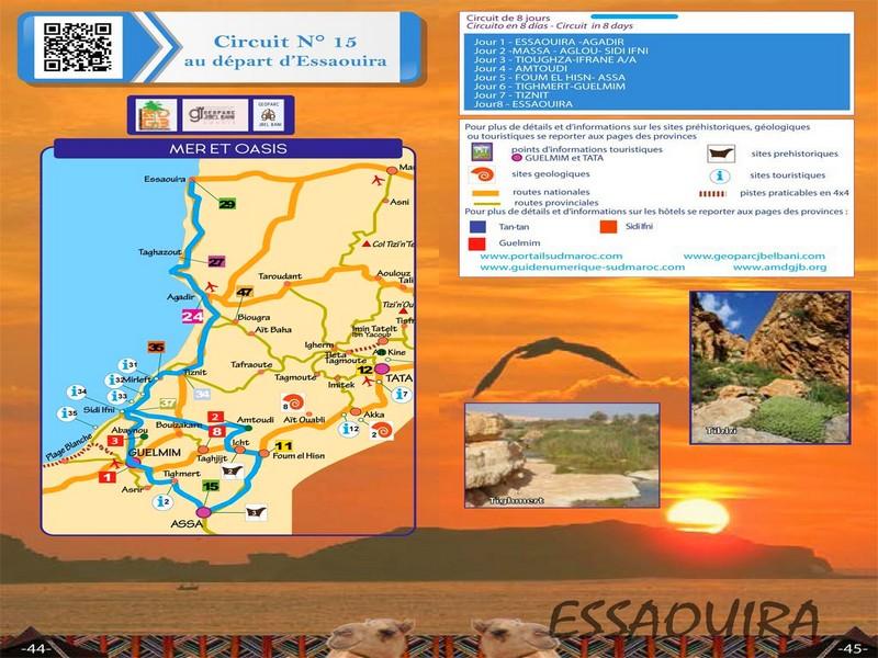
Découvrir les meilleurs circuits touristiques au Souss Sahara Atlantique
Découvrir les autres circuits de la région Sud Maroc
Sites Touristiques Région Souss sahara Atlantique au Sud Maroc
Découvrir les gravures rupestres de la région Sud Marocaine
Chambres d'hôte, hôtels et maison d'hote de la région Sud Maroc
Point Information touristiques et bon plans Tourisme Sud Maroc
Découvrir le méga projet touristique Oued Chbika à Tan-Tan
Tourisme de Niches Oasien- Culturel Sud Maroc

 Découvrir notre région